
Trailrunning the Howe Sound Crest Trail
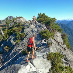
I remember seeing a photo of a section of the Howe Sound Crest Trail (HSCT) when we first moved over. When I saw the photo I knew that I wanted to do it. It looked rugged, beautiful and tough. The caption under the photo said something along the lines of ‘an ambitious overnight hike best done over 3 days’. Wow, that was something far outside my abilities at that time. Fast forward 4.5 years to today and I was joining a jolly group of trail runners (Jeff, Chloe, Adam, Joel, Shannon & Aran) to run the trail in entirety - from Cypress Bowl Ski Lodge to Porteau Cove - approximately 28-30km. This turned out to be a day for the books! The weather couldn’t have been better, the company was fantastic and with the views we had there was no way we set any speed records because every corner we turned ended up being the perfect photo opportunity. Sidenote: If you are attempting the HSCT it is recommended to do it from South to North as this will ensure you a day of net descent, which you will greatly appreciate at the end of your hike or run. The first water source is at Magnesia Meadows, which for us at this time of a dry year, was a tarn. We treated/filtered the water here. The next water source was just past the Brunswick hut, about 1km. I drank from this creek without treating the water, however please do so at your own discretion. On a dry sunny day this trail is stunning! Be aware that there are boulder field crossings, a few narrow trail sections and roped sections for aid - so attempting this trail in less than ideal conditions will alter the difficulty. I highly recommend this trail - either as a run or an overnight backcountry trip. It is an iconic North Shore adventure. So get out there, be safe and start adventuring! Here are some of the best views and highlights from the day: Nothing like catching the dawn glow Views from St.Marks Summit Bluebird sky I’ll let you guess on this one Traversing the base of West Lion Chloe taking in the views Coming up to the Lions Boulder field Roped section Adam running beautiful trail Brunswick Emergency Shelter Pristine...
Acorns, Part 3: The Stawamus Chief
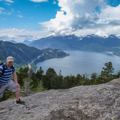
<Acorns, Part 2: Starvation Lake “The Chief” is a large dome of granite that overlooks the main core of Squamish (official name: Stawamus Chief Mountain). If you’ve been through Squamish you’ve seen it. When we started meeting people in Squamish for the first time and told them we were getting into hiking almost everybody asked us “have you hiked the Chief?”. We did some research and found out it was a steep hike up the backside of of this granite dome which eventually leads to some scrambling and walking up granite slabs before reaching the most popular summit, the South one. People generally rated it as difficult and, I’m not going to lie, we were pretty apprehensive about attempting it at first. It was going to be the first summit that we’d hike to the top of in Canada. At that time we still didn’t really understand how elevation gain would affect the difficulty of a hike. We put it off for a while, convincing ourselves that we weren’t ready yet. We began to hear more horror stories from people who’d slipped on the wet rocks or had pushed themselves to the point of throwing up due to how steep and sustained it was. It all just added to the notoriety of it. Eventually, cautiously, we decided to attempt it. This was back in 2010 and the Chief wasn’t near as popular back then as it is today. Today the trail has been vastly improved. Wooden staircases have been installed for the lower scrambly sections and the trail has been rerouted higher up to avoid difficult wet sections. Back then you couldn’t actually just start hiking the trail, it started with a section of rock that you had to scramble up to access the trailhead, beside a large sign that read “This is not a walk in the park”. We scrambled up these boulders and began heading up. Within a few meters the quads on my legs were burning with a searing pain and I could feel my heart working overtime in my chest. Every 5 minutes I had to stop from the pain in my legs and to catch my breath. My face was turning various shades of red and purple. This is what dying feels like Boulders, before we knew climbing them was a thing I remember that first ascent taking a long time. In reality it took us about 2 hours to get to the top but our progress was excruciatingly slow. Spring was definitely more capable than I was at that point so she waited patiently as I stopped every few feet to rest. About...
Buckin Hell Race Recap
Once again I had a serious case of FOMO and signed up for another Coast Mountain Trail Series race about 4 days before the event. I had a few friends doing it and one friend, Adam, was volunteering. This one was called Buckin Hell. It was full of technical trail that ran from Deep Cove to the Seymour Lookout and back down again. There was a 15km & 21km option. I had already decided to run the 47km Squamish 50 Orientation run the very next day and thought adding the 21km race the day before would make for a great training weekend. To my surprise and delight Leigh decided that since I had a weekend full of running,he would get in on the action too and signed himself up for the 15km race. Finish line smiles! Photo credit: Sarah Stepec And we’re off! Photo credit: Brian McCurdy Beautiful day for a race. Photo Credit: Brian McCurdy No point getting bogged down in the details of the race, other than to say this was a hard, beautiful, hilly, flowy and technical course. Yes it was all of those things! Having run in the area on previous training runs, I knew that it was going to be alot of uphill at the start. I didn’t want to start out too fast for fear that I would burn out too quickly. Also in the back of my mind I knew that I had a big run ahead of me the next day There was a strong field of women runners that day. Kim Magnus (1st) & Ellie Greenwood (2nd) created a huge gap between second and third place. Me and my friend Chloe Gendron ran together for much of the race, vying for 3rd and 4th position. I knew from the start if I kept Chloe in my sights I would be finishing up front, so I did the best I could to stick close to her. Leigh looking strong on the descent. Photo Credit: Brian McCurdy Keep pushing. Photo Credit: Brian McCurdy Leigh on a technical section. Photo Credit: Brian McCurdy I was fighting to hold my position on the last big uphill section. I wasn’t sure where I was in the race until I saw the leading women Kim & Ellie racing down the hill. Chloe broke away from me on the climb, but I could see her ahead and then it was just me! I was in fourth place, so close to podium finish but it wasn’t going to happen this time. I struggled to the top of the hill, with a mix of power hiking and running, downed...
Mount Corriveau: We, like, totally did it!
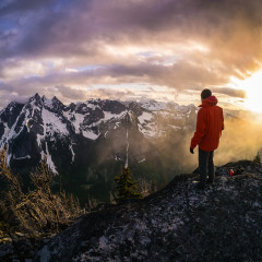
Last Summer I worked for a few months as a Landscape Gardener. Daily we’d go to these palatial mansions in West Vancouver and preen these extravagant, terraced gardens. At one such house I noted that their garden terraces dropped down from their front windows so that the people living their couldn’t even see their own front garden. Across the street from them was another house whose occupants did not care how their garden looked. There was an old car, rusting and broken, a dog tied up running in circles, patches of weeds and dirt and states of general disrepair. But it didn’t matter, their view was of all the terraced gardens across from them. They had the best view on the street and everyone else around them was paying us gardeners to give it to them. In many ways I’ve seen parallels to this while in the mountains. The dramatic, jagged peaks, with impressive prominences beckon the Mountaineer to climb, but once on their summits we lose sight of the mountain below us. While I am drawn to climb to the prominent summits, at least once a year I also try to visit and camp on an obscure summit that doesn’t stand out in its own right, but has the best seat in the house to view another mountain, or range, nearby. I began this tradition near the end of 2012 when we camped on Panorama Ridge. An unimpressive ridge with a minor bump for a summit that has the best view in Garibaldi Park. After that I began scouring reports for other, similarly unimpressive peaks with impressive views. Last year in 2013 we visited Empetrum Peak, a knolly bump with a view across to the dramatic Black Tusk. Camping on Panorama Ridge The Black Tusk from Empetrum On another trip last year, while scrambling to the summit of Welch Peak, I seen an impressive group of mountains near the horizon across from us. I asked others with me what they were and was told they were the Rexford group of mountains. While those jagged spires of rock drew my attention I was also interested in a ridge I could see that ran parallel to them. This ridge appeared to have an amazing vantage point across a valley to those striking peaks. I made a mental note to do some research about it later and possibly put it down as a viewpoint location for 2014. After a bit of research I found out that the high point on this obscure ridge was actually a named summit, Mount Corriveau. After a bit more research I found some information about a...
The Shoulder Season Shuffle
Before moving from Ireland to Canada I had never heard the term “shoulder season” before. Largely because Ireland only has 1 Season, which is that it’s rainy, a little cold, a little warm, sometimes sunny, all year round. Whereas Canada, more specifically, Southwest British Columbia where we live, definitely has 4 distinct seasons, well, that isn’t entirely true, it’s more like 2 seasons with 2 shoulders abutting them. The two main seasons are Winter and Summer, or, colloquially for outdoor enthusiasts, Snow Season and Bug Season. Spring and Fall feel like blips on the radar, as soon as they start it feels like they’ve already ended. Which is why they’re known as the shoulders, Fall is the trailing edge of Summer leading into Winter, and Spring is the trailing edge of Winter. They’re periods of transition and flux, before the relatively stable conditions of Summer and Winter settle in. This flux creates, predictably, unpredictable weather. You can have daytime highs in temperatures that feel like Summer and nighttime lows that feel like Winter. Trusting forecasts even a day in advance is usually a fools errand. At this time of year, personally, I try to look at the forecast the morning of a trip and even then I take it with a pinch of salt as the weather can vary, dramatically, in the mountains from valley to valley. At this time of year, in the Fall, if you want to continue experiencing the outdoors, you have to be flexible and zen about it. You have to be mentally prepared for the fact that, even though the forecast is for sunshine it may in fact start snowing on you on the top of a mountain. As the song goes “Que Sera, Sera…” Last weekend, the first weekend of October, was a typical Fall weekend. The preceding weekend had seen the mountains in our corner of British Columbia turn, almost overnight, from Summer to Winter. A large storm had rolled in and dumped massive amounts of precipitation on everything. People sometimes say to me “You’re Irish, you must be used to the rain”, I can tell you, we don’t get rain like that in Ireland. It was “biblical” as the expression goes, with curtains of rain coming down. We were signed up to run the Rubble Creek Classic that Sunday, a ~25km trail race through a high mountain pass in Garibaldi Provincial Park. By early on Saturday though the organizers postponed it to the following weekend. In typical fashion, we shuffled things around with word of the postponement and went for a run locally. This weekend the forecast looked good and I...


