
Wedge Mountain: North East Arête
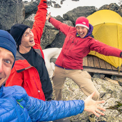
On the first weekend in June, 2013 myself, Spring and our friend Ben decided to try a classic Alpine Mountaineering route in Garibaldi Provincial Park called the North East Arête of Wedge Mountain. Myself and Spring had been to this peak before. Two years previously we had reached the summit of Wedge Mountain as a day trip that took us over 15 hours and required thousands of meters of elevation change. Back then we were still pretty green in our Mountaineering abilities so we didn’t even consider the NE Arête as an option to reach the summit so we took the West Ridge, which is considerably less classic as an ascent route due to it being a long, tedious slope of loose scree, talus and general Type 3 fun. Still, on that trip I took the following picture, possibly my favorite picture of all time so Wedge Mountain has a special place in my heart. We planned a revisit with Ben to attempt a more aesthetic route, but this time we’d do it in a more Mountaineering style by splitting the trip over 2 days, and getting an early alpine start from a base camp near the foot of the peak. We set up our tent at Wedgemount Lake and introduced ourselves to some other parties staying in the modest shelter nearby who had intentions to climb the North East Arête also the following morning. We had dinner lazily and turned in early for the coming alpine start which would have us up and ready well before sunrise. The next morning we awoke, and after getting some calories and caffeine into us we were off. We moved briskly but immediately I noticed something different to this start than other alpine starts I had done before. It was no later than 4am but it was warm out and the snow underfoot did not have the satisfying crunch that I expected. Usually, snow in the alpine in the Spring softens up through the day and then hardens up again overnight as the temperatures drop. This snow had clearly not gone through this cycle as there had been no winds overnight and the freezing level had stayed high. It was a bad sign about conditions we might face higher on the mountain but we pressed on. There was still the chance that conditions higher up on the mountain might improve as it was less sheltered from the wind and more likely to be within the freezing level. Shortly thereafter we met up with the other parties that had started earlier than us as we roped up for glacier travel. We would need...
Welch Peak: Photo Essay
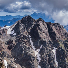
On the last Saturday in July, 2013 myself and Spring and two other likely companions, Ben and Cody, reached the summit of Welch Peak in the Cheam Range of British Columbia. The scrambling is airy and exposed but fun. There is just enough solid rock to scramble on to make you forget the crumbling piles of choss or as I decided to call them “death skittles” which is all the loose sand and pebbles atop otherwise good rock (definitely inspired by the fact I was munching on actual Skittles all day). On the Friday night we decided to camp on an old Forestry Road near the trailhead. This proved to be the mental crux of the trip. An overactive imagination and past negative experiences leaving a vehicle overnight in the vicinity coupled with having to camp at a pullout littered with shotgun shells, broken glass and shrapnel embedded trees made for a somewhat restless nights sleep. The next day we reached the summit of Welch Peak. It was a long day, with moments of sheer bliss, pupil dilating terror, brow furrowing frustration and pure comradery in the face of tribulation. At times it felt like we were struggling and wrestling against the mountain but ultimately, as we departed from the summit, and toasted stream chilled Ale back at the trailhead, we felt that the mountain had given us far more on that day than it ever could have taken from...
When Sisyphus met Zeno: Tantalus Digressions
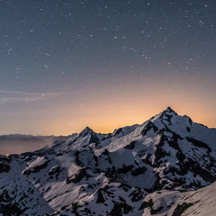
I have a bit of an obsession with the Tantalus Range of Mountains. Most Mountaineers who live near Mountains will let you know that their local peaks that are visible from their work or home can offer more allure than even the high ranges of the Himalayas. For myself, the Tantalus Range has been visible from every place that I’ve lived in the little town of Squamish. It’s peaks are striking, its lakes are pristine and even though it is located close to large population areas you can feel completely isolated when exploring there. What adds to this allure is that it is not easily accessed. A wide and fast river with no legal bridges cuts off most of the central and southern area of the range. If you have the wallet you can fly in via helicopter or float plane or hire a boat to get you across. If you have the stomach you can walk the cables for a locked cable car. I’ve never done the latter myself but heard it is spicy and most people recommend finding another way to cross after they’ve tried it. Alternatively, you can walk in from the North, starting at pretty much sea level. On Canada Day Weekend 2013, myself and Spring planned to walk in from the North and try and access the crown of the Tantalus Range, Mount Tantalus herself. If you’ve driven Highway 99 from Vancouver to Whistler, BC under blue skies your jaw has likely dropped at the sight of Mount Tantalus. An impressive vista opens up and you get to look right into the heart of the Tantalus Range with all it’s most impressive peaks laid out before you. On a clear crisp day the pullout for this viewpoint is usually chock full, from dawn till dusk, with tourists snapping pictures of themselves against the backdrop. After some research about ways to reach this summit I decided to take the road less traveled to try and reach it on foot, accessing the summit via the North Ridge. The consensus online appeared to be to save your energy and fly in to the base of the North Ridge, but I wanted to at least see what the approach would be like. We’d hike in from the North via the Sigurd Creek trail, hike up and over the shoulder of Pelion Mountain (we’d been here before) then follow a ridge that drops a ways down to the South of Pelion and ascend to a col. between Zenith Peak and Mount Tantalus. To reach this col. is no great distance, it’s only about a 15km hike. What puts a...
There.. Are.. Four.. Pitches: Star Chek
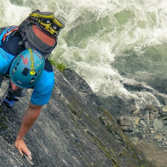
If you’re a die hard Trekkie you may get the reference in the title of this post. If not, then don’t worry about it. A few weeks ago I climbed a multi-pitch route named “Star Chek”, probably named as a play on the name of the popular Sci-Fi show and due to it’s location, above the Cheakamus River, being out of this world. I’d been mentioning this climb to a friend of mine, Adrian, for a while. Ever since I seen pictures of it from reports online the idea of climbing this exposed Arête of rock while a torrent of white water roared below seemed so tantalizing. I’m not at a skill level yet where I could lead it so I’d need Adrian to go on the sharp end of the rope. The stars, pun intended, aligned, and he offered to lead it with me. He’d be passing it on his way North to do some camping so it would work out perfectly. It ended up being myself, Adrian and his better half, Sophie. On the morning of the climb the weather did not seem to be on our side. It was showering and the idea of climbing wet, slick rock was losing it’s appeal. I met up with Adrian and, always the optimist, he said that we should go check it out at least. We got to the parking lot and it was still raining on the windshield of the car. I commented and said that we could do it another time when it was dry if they wanted. Adrian, still being optimistic, wanted to wait. After about a half hour, the rain didn’t seem to be abating much and Adrian said: “We should go”. I initially thought he meant that he wanted to leave and go away, but when I seen him get out of the vehicle and start getting his stuff I realized he wanted to go do the climb. At the very least he wanted to get to the base of the climb and see what the rock was like up close. I’ve written about this in the past in my post “Get your nose against it” and how you should always go as far as you can before turning around but on this day, with it raining, I was thinking about breaking my own rule and throwing in the towel at the parking lot. Adrians gusto was infectious though so we grabbed our stuff and began descending into the gorge that would lead us to the base of Star Chek. After about 10 minutes I noticed something odd. The rock further down in the gorge...
Empetrum Peak: A Photo Essay
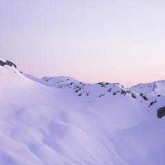
For most people seeing a forecast of straight sunshine through the weekend would be reason enough to jump up and click their heels. It usually would for ourselves also if it wasn’t for the unseasonably warm weather pushing the freezing level way up. Freezing level is important to the Spring time Mountaineer. Ideally a Mountaineer wants the freezing level to be at least at the elevation of the beginning of the route to ensure the snow will be firm and relatively stable to move across. With the freezing level way higher than any of the mountaineering routes we had our eyes on we changed our plans. Empetrum Peak had been on my mind for a while. The peak itself is relatively benign and getting to the summit is pretty straight forward from most aspects. Some mountains are interesting in and of themselves, while others, like Empetrum, are interesting, at least to me, because of the vantage point they offer on other mountains in the vicinity. Empetrum sits just North of the ubiquitous and aptly named “Black Tusk”, a volcanic plug that is an icon of Southwest British Columbia. From this vantage point you can see Mount Garibaldi, directly to lookers left and Mount Tantalus, directly to lookers right of the Tusk, both iconic mountains themselves. I planned for us to spend the night on the summit to see the sunset and sunrise. Being North of the Black Tusk would allow us to see it’s West face painted at sunset while it’s East face would be dark, and then vice versa at sunrise. From a photographic point of view I really like this stark contrast of light and shadow on mountains. One consolation of the high freezing levels was that the temperature on the summit of Empetrum Peak was forecast to be mild with low winds so myself and Spring chose to sleep out under the stars in bivy sacks and forgo bringing a tent. I find a tent to be a mental crutch sometimes, a little piece of civilized space that we bring out into the wilderness with us so that we can escape the wild when we feel at our most vulnerable whilst sleeping. Whenever possible I try to bivy as that connection with nature is never broken. Through the night I’d stir awake and be free to gaze across at the silhouette of the mountain ranges in view and the countless stars above me. The security that is lost from not having a tent is more than made up for in the sense of freedom that is gained. We made two new friends on this trip, Jess and Hailey....


