
Sky Pilot Race Recap
From reading some of our past posts you may have realized that the Sky Pilot is one of our favorite mountains around Squamish. It’s a spectacular alpine area where backcountry adventure is around every corner. So when we heard that the Coast Mountain Trail Series was bringing a trail race to this area, we knew we had to run it! The inaugural race was scheduled for September 21, which could mean beautiful fall weather or torrential rain; it could go either way here on the west coast. With the race being set in such a rugged area there was a lot of trail building happening weeks before the race. Everyone involved in creating this race wanted to make it a unique mountain running experience. The excitement was building when there was talk of roped sections, boulder fields and ridge running. However,days before the race, the endless summer sunshine we had been experiencing changed to the autumnal rains, which meant all of the fresh new trail became streams of mud. The steep trails were now too wet to run and it would be too risky to send all of the runners out onto this terrain. But if I have learnt anything about the Coast Mountain Trail Series races, it’s that they do not disappoint, and with literally hours before the start of the race, a change of route was put in place. They were going to make sure everyone got the mountain running experience they promised! This was some of the rugged mountain trail. Mt. Habrich from the summit point of the race. Checking out the view from the summit. We showed up to the starting line, on a sunny blue bird day at the top of the Sea to Sky Gondola, not totally sure of the new route and curious where exactly it was going to take us. Leigh and I were running this one together and decided to run it as a fun run. No need to race, just enjoy the new course, take a few photos along the way and revel in the scenery. As usual the starting area was buzzing with the energy of runners antsy to start, one of my favorite parts of racing. Just feeding off of that energy can carry you for miles! And we needed that energy to carry us. This course was unforgiving in its ascent. Starting on the tame and gentle uphill Sky Pilot ridge trail, we would eventually be taken straight up to a ridge that connected to Mt. Habrich. Running or rather power hiking up steep, loose, duff covered forest trail, straight onto a boulder field. Crossing the...
Scrambling Blackcomb Peak
This season myself and Spring decided to bite the bullet and buy Ski Season passes for Whistler/Blackcomb. Last Winter we simply didn’t get to ski near as much as we wanted. Very little of the fluffy white stuff fell early in the season and then a few weak layers appeared in the snowpack creating persistant avalanche concerns. A lot of our free time was spent waiting out bad weather, waiting for more snow or waiting for the avalanche risk to drop. We’re total ski novices, so we didn’t want to push our abilities under those conditions. This season, even if the weather is bad, we can ski at Whistler inbounds at the resort. We only really visited Whistler for the first time last Spring and we were amazed by the amount of terrain it gives access to. We expect to use it for ski practice under bad conditions and access to backcountry terrain under good conditions. A benefit to buying the Ski passes was that we got free Summer passes for hiking from the Gondola tops. Initially we imagined we’d be using these a lot this season but things didn’t work out that way. We didn’t use them at all. We’re still bitten with that West Coast ideal that mountains have to be earned and that requires hiking them from the bottom up and not using gondolas to bypass the slog to get above the treeline. However, with the hiking season coming to a close, and the mountains beginning to feel like the snow is about to fly any day now I wanted to use my free Summer pass at least once. Similar to my Mount Cook report, I had a free day when Spring was working so I decided to visit the summit of Blackcomb Peak solo. I actually imagined I’d be accompanied by other scramblers but that wasn’t to be the case. I arrived in Whistler late in the morning, joined the throng of tourists heading up Whistler Mountain, then took the Peak2Peak gondola across to Blackcomb. The place was buzzing with tourists. It’s not usual that my days in the mountains begin at 6200ft, surrounded by people in cotton and denim and the buildings and machines of modern society. I’m glad that this experience is still novel and not the norm. Fine day for a gondola ride A hungry snafflehound I headed out quickly on the trails. I knew that my time was limited. I had been tardy and it was already close to noon and the last gondola down the mountain was at 5pm, and I wanted to be on it. I could of course...
The Copilot: How civilized!
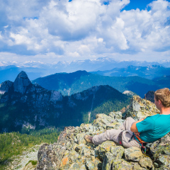
We have had more than a few hikes/scrambles around Southwest B.C. that have made us earn our right to be there. They consisted of either an approach on miles of logging road that is so graciously referred to as a “slog”, a heinous bushwack or alder thrash that scratches and slaps at any exposed skin or sometimes if we were really lucky we have had to ford some sort of raging ice-cold water to further our progress. But we have slowly become accustomed to the ways of the wild in B.C. and you could say we have developed a special fondness for them. The scenic ride to the top Looking at our objective The views just don’t get old However, since the arrival of the Sea to Sky Gondola a certain civility and european feel has been brought to one of our local mountain areas: Sky Pilot. The trail has been tamed. We no longer have to endure miles of approach on logging road or thrashing through alder to arrive at our destination. No, now we have a scenic 10 minute ride up in a cable car, a cafe at the top should we need one more caffeine boost before we set off and a well-groomed trail that leads us straight to the alpine. If you didn’t know any better you might actually think you were in a little European town in the Alps. Going up… and up Copilot This August, however,our sights were set on a lesser named bump in the area, The Copilot. Next to Sky Pilot it looks much less intimidating, as it doesn’t quite take up as much of the skyline as it’s better known, better half. But, seeing as we had already scrambled Sky Pilot a few years earlier (If you want to see how our first trip went in this area, pre-gondola, take a look at our successful attempt to climb Sky Pilot in 2011.), we set our sights on this smaller objective and what turned out to be a mini alpine adventure, only minutes from our home. Climb on Summit Selfie Lounging up top More views Despite it’s smaller stature this is still a stiff scramble and should only be attempted by those with the experience,gear and skill to do so. The climb itself is short, approx 90m up the Northeast gully. It’s an obvious line that is filled with loose rock halfway up, so wear a helmet. There were no issues scrambling this section and we made a note of the rappel stations, good sturdy trees, on the way up. We brought the necessary equipment to rappel the route as...
Trailrunning the Howe Sound Crest Trail
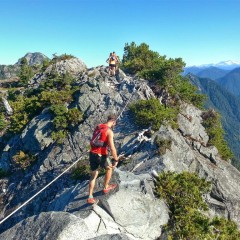
I remember seeing a photo of a section of the Howe Sound Crest Trail (HSCT) when we first moved over. When I saw the photo I knew that I wanted to do it. It looked rugged, beautiful and tough. The caption under the photo said something along the lines of ‘an ambitious overnight hike best done over 3 days’. Wow, that was something far outside my abilities at that time. Fast forward 4.5 years to today and I was joining a jolly group of trail runners (Jeff, Chloe, Adam, Joel, Shannon & Aran) to run the trail in entirety - from Cypress Bowl Ski Lodge to Porteau Cove - approximately 28-30km. This turned out to be a day for the books! The weather couldn’t have been better, the company was fantastic and with the views we had there was no way we set any speed records because every corner we turned ended up being the perfect photo opportunity. Sidenote: If you are attempting the HSCT it is recommended to do it from South to North as this will ensure you a day of net descent, which you will greatly appreciate at the end of your hike or run. The first water source is at Magnesia Meadows, which for us at this time of a dry year, was a tarn. We treated/filtered the water here. The next water source was just past the Brunswick hut, about 1km. I drank from this creek without treating the water, however please do so at your own discretion. On a dry sunny day this trail is stunning! Be aware that there are boulder field crossings, a few narrow trail sections and roped sections for aid - so attempting this trail in less than ideal conditions will alter the difficulty. I highly recommend this trail - either as a run or an overnight backcountry trip. It is an iconic North Shore adventure. So get out there, be safe and start adventuring! Here are some of the best views and highlights from the day: Nothing like catching the dawn glow Views from St.Marks Summit Bluebird sky I’ll let you guess on this one Traversing the base of West Lion Chloe taking in the views Roped section Coming up to the Lions Boulder field Adam running beautiful trail Brunswick Emergency Shelter Pristine...
Running the Squamish 50 - 50 Mile
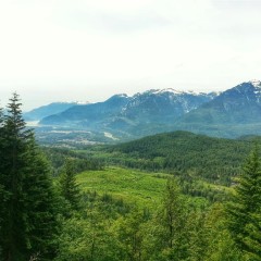
So I actually did it. It still feels a little bit like a dream really. The months of physical preparation, the mental anguish I put myself through, were finally put to the test on August 16th when I got to run the Squamish 50 (50mile/80km) trail race. There was so much trepidation leading up to this day, unsure I would actually be able to complete the full distance. The longest run I had done leading up to race day was 50km and I just hoped that race day endorphins would pull me through the extra 30km that my legs would need to carry me that day. But how exactly did the day unfold? My good friend and fellow racer Sarah toed the line with me that Saturday morning for the 5:30am start. We hugged each other, wished each other a strong race and didn’t see each other until the end. In my mind that morning, I had Sarah’s advice floating through my mind, “for your first 50 miler go uncomfortably slow for the first half”, hopefully this would help me reserve energy for the second half of the race. Coming into AS #2. Re-fuel Getting words of wisdom from Leigh The first 10 km was flat and despite the easy start to the race I forced myself to keep the pace I knew I wanted to hold. ALOT of people passed me and I tried to not let it bother me as I knew there was a good chance I could catch some of them on the second half and it also gave me a chance to find a rhythm; pacing is an art that I was hoping to master that day. The first aid station was 10 km in. Here I saw Solana & Jay, cheery as always, manning the station and cheering the runners on. This is when I first saw my personal crew, my favorite person and better half, Leigh. He was there with a “How are you feeling” “What do you need?” and with a few clicks of the camera and a kiss, I was off. The next 10km had a hilly and technical middle portion. Sarah and I had actually discussed the previous night how we were not looking forward to this particular section as it seemed so brutally steep on the last training run. But this day it didn’t feel as bad as I had remembered, maybe because I knew there was so much more ahead of me that day. It was still steep, dry and dusty so there was some hard power hiking happening. Climbing is something I have the long gait...
Mount Cook: Alone in the Mountains
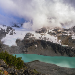
I’m not a solo hiker. I know people who spend a lot of time alone in the wild and choose to climb mountains by themselves but I am not this kind of person. It isn’t out of fear or even out of a rational sense of safety. It’s actually just a visual preference. I like seeing people move in the mountains. I prefer to shoot pictures of people against mountainous backdrops and try to document how they interact with the environment. All of this subject matter for my photography is lost when I go there alone. However, recently I had a day free during the week when Spring was working. I had an itch to get up high into the mountains but I also wanted to visit a peak that I’d never been to before. The decision to head to Mount Cook was an easy one. It’s a technically easy mountain to climb and it’s a good workout, climbing steeply to around 2676 m (8780 ft), but more importantly, Spring had already been up this mountain before by herself a few years ago when I was recovering from an ankle injury. When you are surrounded by thousands of mountains, and you always have the option of visiting a new one, it can be hard to get a mountain climber to accompany you to a mountain they’ve already been up, especially if the route is technically easy. While I know Spring would definitely accompany me up Mount Cook if I asked, I didn’t want to have to ask. So I went alone, as she did. Wedgemount Lake under clouds Wedgemount Lake Respite in the shelter The climb up was straightforward. I fast hiked to the lake below the mountain, Wedgemount Lake, in a few hours. Clouds hung low on the summit of Cook but I pressed on, hoping for them to clear. Soon above the lake I began to leave all vegetation behind as I started to walk up slopes of rubble and dirt. A recent storm had dumped snow on the upper reaches of the mountains and the wind had formed it into fingers which streaked across the bare slopes. Loose snow on unstable scree is challenging so I tried to traverse around these sections were possible. When I did have to cross them I made sure to probe ahead with my hiking poles so that I wouldn’t step into what is affectionately called an “ankle breaker”, a hole between some small boulders obscured beneath loose, unsupportive snow. I gained the subsummit of Mount Cook in short order and kept moving, within a short while of hiking along this broad...


